A rugged coastline dotted with giant sea stacks and tidal pools. Large pods of seals sunning on the rocky edge of an island. A golden eagle soaring just above the trees, while gangling herons spar over the best low-tide fishing spots. And just a hint of danger from bears known to roam the woods and beach.
The 9-mile Ozette Triangle Hike starts in a Northwest rainforest that spills down to a stretch of wild Pacific coastline in the Olympic National Park near the northern tip of Washington’s Olympic Peninsula.
For generations, the popular hike and beach campout have been a rite of passage for many young people, a point made clear at the trailhead parking lot when a middle-aged dad piled out of a car with his young sons and said he used to come to Ozette Beach with his dad when he was a kid.
Ozette is 76 miles west of Port Angeles, or a two-hour drive on winding, two lane roads best driven in daylight. We took U.S. Highway 101 to State Road 112. At Sekiu, we turned left on Hoko-Ozette Road, passing through forestland and logged hillsides spiked with old tree stumps and fresh seedlings.
The trailheads start at Ozette Lake near the Ozette ranger station. Overnight backpackers need a wilderness permits, which were still available on a sunny Saturday in August, even though the parking lot was crowded with vehicles. Campers are also required to carry bear barrels for food storage, which were available at the ranger station.
Since we were there for a day hike, we did the entire triangle, or loop hike, starting with the 3-mile boardwalk hike to Cape Alava. We started at an arched moss-covered wooden bridge over the Ozette River and walked through a forest thick with cedar and spruce. After about two miles, we passed through an old homestead site called Ahlstrom’s Prairie where we could hear the sound of the surf and barking seals even though we were a good mile from the ocean.
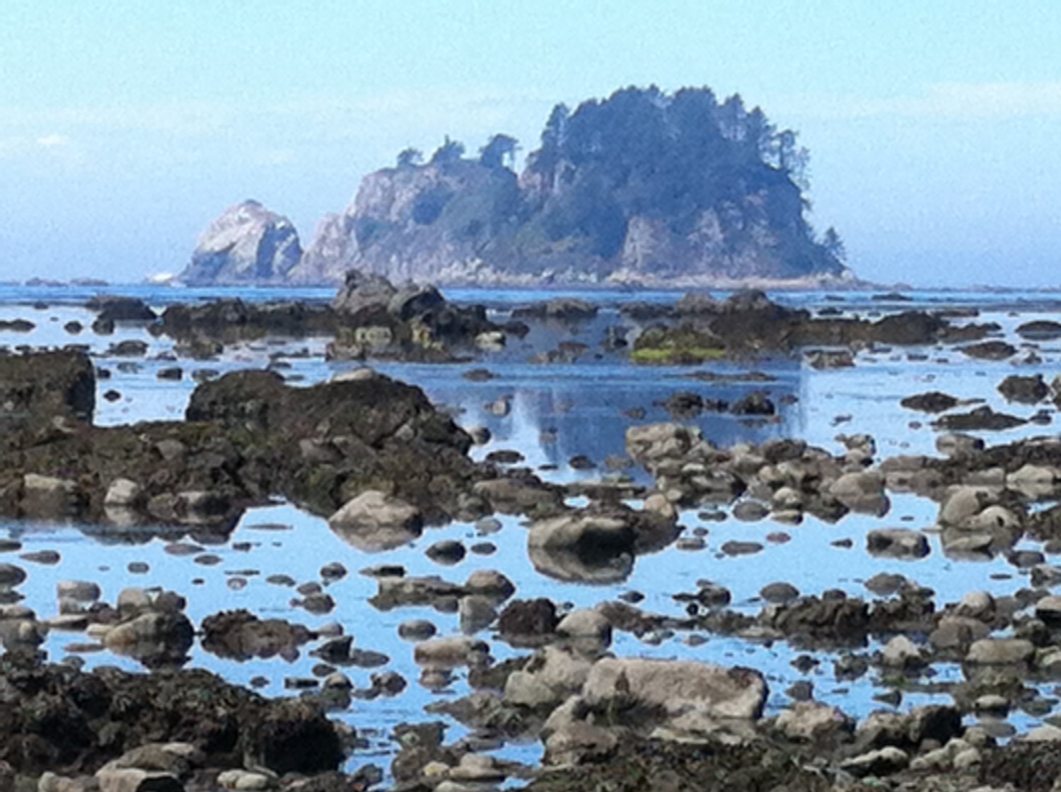
On the steep final descent to the beach, we passed backpackers heading back to civilization after an overnight at Cape Alava, a rocky beach with clearings in the trees for tents and views of several islands just offshore, including one teeming with pods of noisy seals lazing on the rocks.
From Cape Alava, we walked south along the beach, a hike best taken during low tide. We lingered among the tidal pools, looking for sea amenities and tiny bits of coral.
Halfway along the beach, in a cluster of boulders called Wedding Rocks hanging close to the shore, you can find ancient, sacred Makah petroglyphs depicting orcas or fishermen carved in stone. Beyond Wedding Rocks, more sea stacks and smaller rocks, popular with cormorants and fat seals.
At Sand Point, we found more primitive campsites. I climbed a tall stack at the point and saw miles of sandy beaches to the south. From Sand Point, another 3-mile boardwalk hike through the forest takes you back to the ranger station. Along the way I soaked it all in and plotted our next trip back.
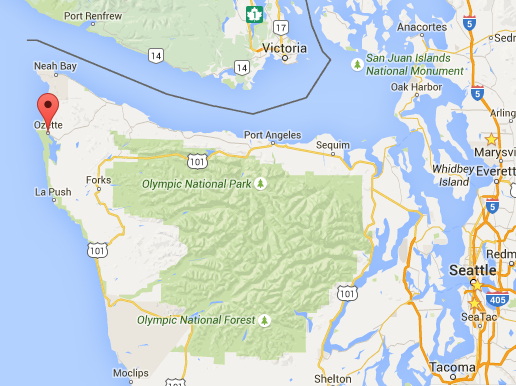
Ozette is 76 miles west of Port Angeles, or a two-hour drive on winding, two lane roads best driven in daylight. (Click on image for interactive map).

Hello mate grreat blog post
LikeLike